

Invests 90L, 99L among 4 tropical systems being monitored for development in Atlantic: NHC
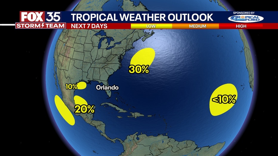
Forecasters with the National Hurricane Center (NHC) are monitoring four tropical disturbances swirling in the Atlantic Basin, including a newly designated Invest 99L off the U.S. East Coast and Invest 90L off the Gulf Coast.
An "invest" is simply a naming convention the NHC uses to identify areas they are investigating for possible development into a tropical depression or tropical storm within the next seven days.
Invest 99L off Mid-Atlantic seaboard
The NHC said Invest 99L is located a few hundred miles east of North Carolina and is producing showers and thunderstorms to the northeast and east of the system's center.
Invest 99L could acquire some subtropical characteristics over the next few days while it moves to the north-northeast. On Thursday, the NHC said showers and thunderstorms assorted with Invest 99L are becoming better organized and producing gale-force winds.
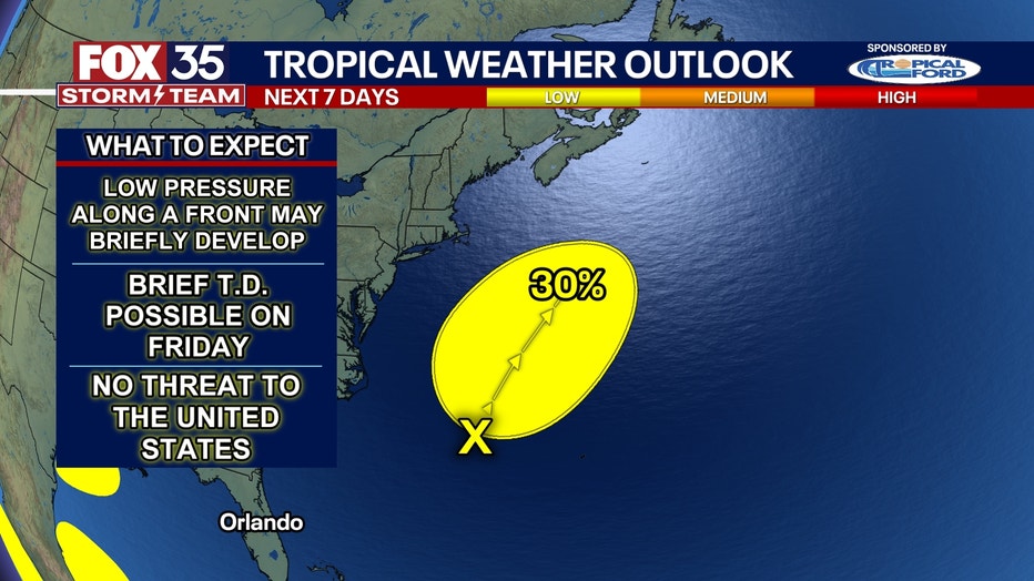
Invest 99L is expected to remain off the Northeast coast, and once the system moves over cooler waters by late Saturday, further subtropical development is not expected.
The NHC is giving Invest 99L a low chance of developing.
Invest 90L near Texas coast
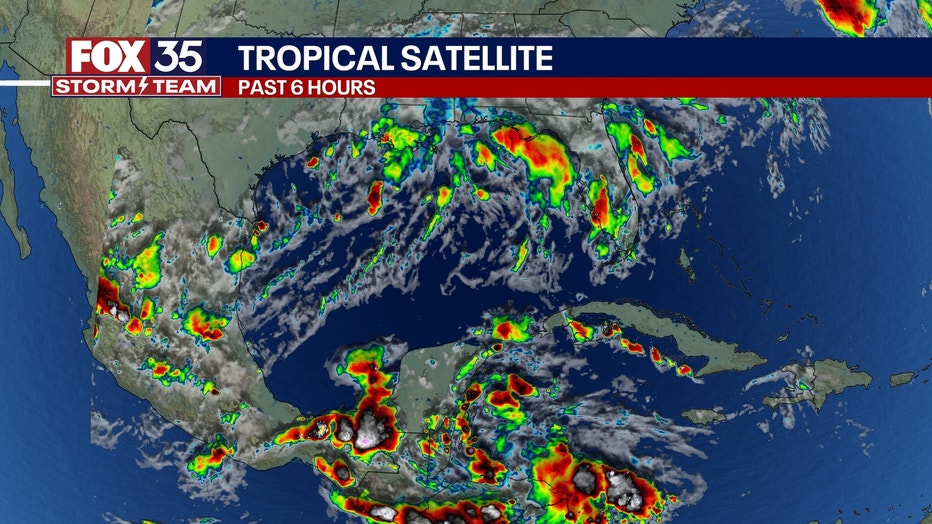
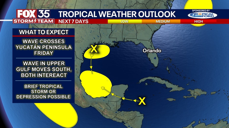
A disturbance in the Gulf of Mexico off the Texas and Louisiana coasts, now dubbed Invest 90L by the NHC, is being monitored for possible tropical development over the next few days.
This area of disturbed weather has been blasting the Gulf Coast with heavy rain over the past several days, but the NHC dropped development odds earlier this week.
However, in its update on Thursday morning, the NHC once again said it would watch the system and later in the day gave it the invest designation.
The NHC said upper-level winds are expected to become less conducive for development by Friday and Saturday as a front approaches ther area.
Disturbance in Caribbean Sea
A tropical disturbance is moving quickly to the west at about 20 mph over the western Caribbean and is continuing to produce a broad area of disorganized showers and thunderstorms.
The NHC says some development of this system is possible in the next few days after the system moves across Mexico's Yucatán Peninsula and then into the southwestern Gulf of Mexico. The system has been given a low chance of developing over the next week.

Tropical disturbance in eastern Atlantic
A tropical disturbance over the eastern tropical Atlantic is producing a broad area of disorganized showers and thunderstorms. The NHC said slow development is possible over the next several days while the system drifts to the northwest or north.
The disturbance has a low chance of developing over the next week.