

Weekend severe weather threat cranking up, moves closer to Florida
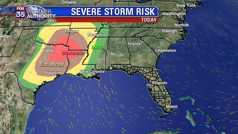
ORLANDO, Fl - The risk for some powerful storms will increase across the Gulf South and mid-section of the nation Friday.
A moderate risk of severe weather packing a damaging wind threat and tornadoes will cover areas around the Texas/Oklahoma border, an enhanced risk sets up from Dallas to Austin on over to Houston. Warm, moist Gulf of Mexico air streaming into these areas all day will provide the fuel for the weather burst.
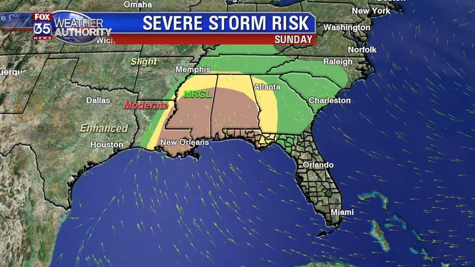
On Saturday, the threat of severe weather continues marching Eastbound and could involve the Florida Panhandle late in the day, overnight into early Sunday. While the risk is lower overall during this time, damaging winds and tornadoes are still possible so it's critical that people in the areas of concern remain weather aware.
For those of us living on the Florida Peninsula, specifically in the FOX 35 viewing area, expect only showers with low coverage chances on Saturday. Local breezes will continue propelling a few showers into East Central Florida over the weekend.
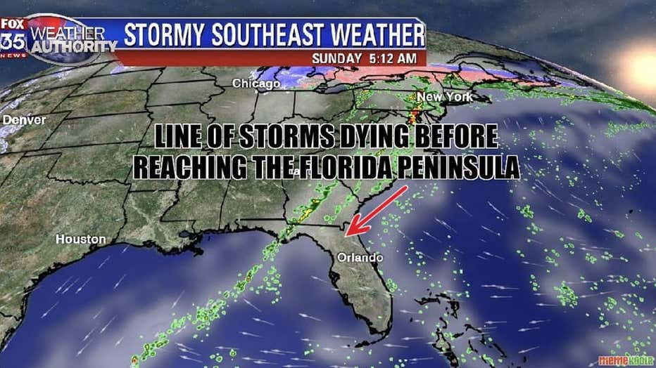
Latest forecast modeling from the FOX 35 Weather Center is indicating a weakening trend of the stormy weather as it encounters high pressure out in the Atlantic. The High will serve as a body guard of sorts for much of Florida, forcing the weakening band of storms to ride North of Central Florida and into the Western Carolinas late weekend.
Be sure to download the FOX 35 Weather App to get your daily forecast.