Tropical Storm Fiona: Is it headed toward Florida? Here is the latest projected pathway

Tropical Storm Fiona formed in the Atlantic Ocean late Wednesday – becoming the latest named storm of the season – after satellite data confirmed maximum winds of 50 mph.
The National Hurricane Center expected then-Tropical Depression Seven to strengthen and become a tropical storm.
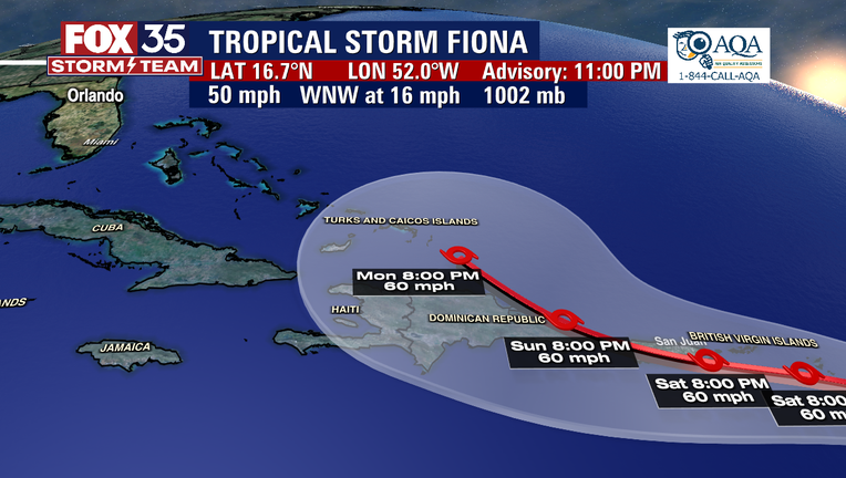
Here is the latest on Tropical Storm Fiona (as of 11 p.m. Wednesday)
Location: About 650 miles east of Leeward Islands
Maximum sustained winds: 50 mph
Direction and speed: WNW, at 16 mph
Minimum central pressure: 1002 MB
What's Tropical Storm Fiona's projected path?
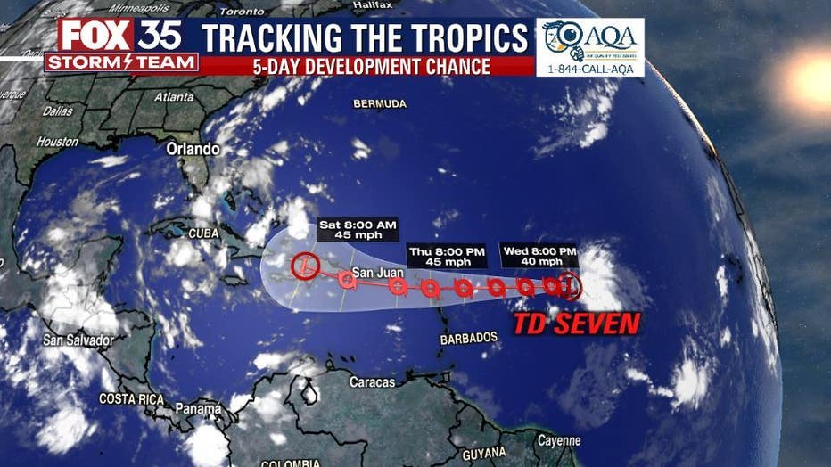
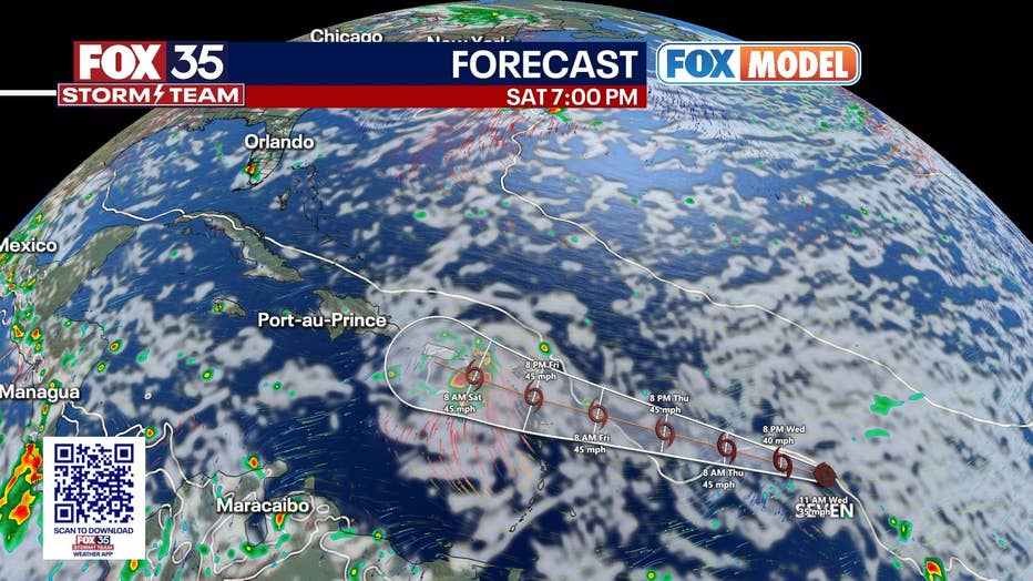
The FOX 35 Storm Team is watching the models of the system. It could move near or over portions of the Virgin Islands, Puerto Rico, and Hispaniola this weekend and early next week. Those areas will likely see heavy rainfall and some wind impacts.

Since the storm's maximum sustained winds have reached 40 mph, the system has earned the name Fiona, FOX Weather reported.
The Netherlands, St. Maarten, Montserrat, Antigua, Barbuda, St. Kitts, Nevis, and Anguilla have all issued a Tropical Storm Watch.
A Tropical Storm Watch means that tropical storm conditions are possible within the watch area, generally within 48 hours.
Fiona is expected to produce total rainfall accumulations of 3 to 5 inches with maximum totals of 8 inches across the northern Leeward Islands, the British and U.S. Virgin Islands, Puerto Rico and eastern Hispaniola, according to the National Hurricane Center.
These rains may produce isolated flash and urban flooding, along with isolated mudslides in areas of higher terrain.

Will Tropical Storm Fiona impact Florida?
For now, there are no immediate impacts expected in Florida other than rough surf along the Atlantic coast and possibly more tropical moisture.
Most models have the storm getting ripped apart by the Caribbean islands and then turning north out into the Atlantic.
Nothing is certain yet, but the FOX 35 Storm Team will continue to be keep a close eye on it.

