

Orlando weather: Windy weekend brings rough surf, coastal flooding concerns
Orlando Weather Forecast: Gusty wind, few showers this weekend
Meteorologist T.J. Springer is tracking the potential for hit or miss showers as we progress through the remainder of our Saturday. The plus is it won't be a washout. Tune in to see who has a higher chance of rain and how strong the wind gets.
ORLANDO, Fla. - The wind is becoming a bigger story once again with a disturbance circulating just offshore to our east. This, as well as the onshore flow, will lead to chances of rain returning to the forecast as well as rough beach and boating conditions as we progress through the weekend.
GUSTY WIND AND COASTAL SHOWERS TODAY, DRIER PATTERN COMING
A tight pressure gradient between high pressure anchored across the eastern U.S. and lower pressure over the Atlantic will keep a brisk northeast-to-east breeze locked across Central Florida today.
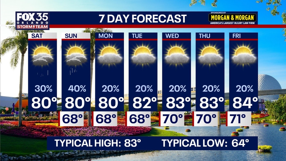
This onshore flow will steer quick-moving bands of scattered Atlantic showers ashore, keeping rain chances around 50% near the coast and 30% across the interior.
These showers will be fast-moving, but can produce brief, localized downpours and gusty winds. Rain chances drop off even further heading into next week as drier mid-level air moves in, leading to a little more sunshine.
The chance for showers drops to around 20%, but we'll still hold onto the moisture in the air, leading to times of sun and clouds.
COMFY TEMPERATURES, BUT A LITTE MUGGY
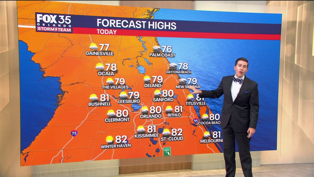
Northeast winds sustained at 15–20 mph with gusts up to 25–30 mph will keep conditions feeling pleasant despite afternoon sunshine. High temperatures will top out in the lower 80s (80°–82°) across the Orlando metro and interior communities.
Coastal beaches will stay slightly cooler in the upper 70s to around 80° thanks to the steady ocean breeze. Humidity levels remain comfortable, keeping midday heat indices in check, but it will be a touch muggier than the conditions this past week.
Overnight lows will dip into the mid-to-upper 60s for the metro, while northwest counties like Marion, Lake, and Sumter will see slightly cooler readings in the lower to middle 60s. Along the immediate coast, temperatures will hold in the low 70s overnight.
DANGEROUS BEACH AND BOATING CONDITIONS
The persistent onshore winds will make for hazardous marine and surf conditions along the Atlantic coastline. A Gale Warning is in effect as seas build to potentially 10–15 feet offshore in the Gulf Stream.
Along the beaches, expect large, pounding, breaking waves, rough surf, minor beach erosion around high tides, and a high risk of life-threatening rip currents. A High Surf Advisory is in effect through Monday.
Swimmers and beachgoers are strongly urged to stay out of the water. A Coastal Flood Warning is also in effect with flooding possible in flood-prone areas near the intracoastal and the beaches.
TRACKING THE TROPICS
The Atlantic basin remains tranquil close to home. The National Hurricane Center expects no tropical cyclone development across the Gulf, Caribbean Sea, or local Atlantic waters over the next 7 days.
Pockets of dry mid-level air and unfavorable upper level wind shear continue to suppress any organized tropical activity. There are zero tropical threats to Florida or the U.S. coastline, but the Storm Team will continue to monitor the basin closely.
The Source: This story was written based on information provided by FOX 35 meteorologist T.J. Springer on October 24, 2026.