Orlando Weather: Mainly clear skies ahead of workweek

Orlando Weather Forecast PM: Oct. 26. 2024
FOX 35's Laurel Blanchard has your latest forecast for Sunday.
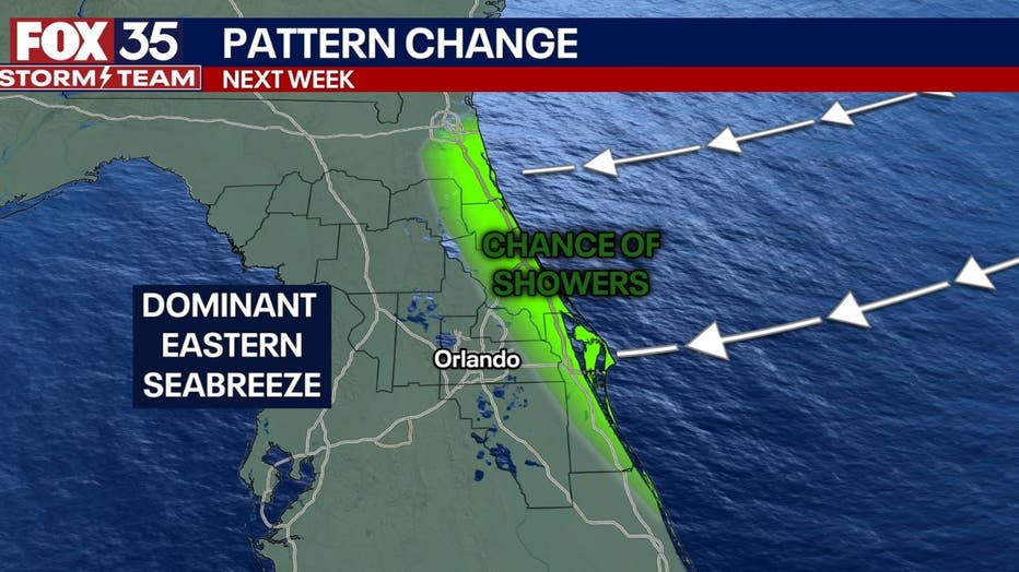
ORLANDO, Fla. - Winds will help push in moisture from the Atlantic for some possible Tuesday showers on the east coast of Florida as we near the week ahead.
TONIGHT: Mainly clear skies are on tap through the overnight tonight. Temperatures will fall through the low 60s in areas near I-75, mid 60s closer to the Orlando Metro area and upper 60s in areas along the east coast and I-95.
START OF THE WORK WEEK: Winds will switch around and come in from the northeast pushing in moisture from the Atlantic and creating some scattered showers that will move in Tuesday through Friday. Not seeing too much of a rain chance for areas near the Orlando Metro or I-75 but the east coast beaches will see more cloud cover and a few sprinkles.

TROPICS: We are watching the tropics once again. There is a 40 percent chance of tropical development within the next 7 days in the Southern Caribbean. its too early to talk specifics but there are a few trends that the tropics follow this late in the season. We have been keeping an eye on this zone for a little bit now. With the warm ocean water and little shear, it is a zone that holds a favorable environment for a tropical system to form.Usually this late in the season, we see 3 scenarios when it comes to tropical paths.
Scenario 1 - a strong ridge of high pressure sets up over the southeast and steers any tropical development to the west following the path of Nadine.
Scenario 2 - Jet dips down but does not push out to the Atlantic causing storms to steer closer to the east coast with dominant high pressure over the central Atlantic.
Scenario 3 - Jet dips down and does push off the east coast allowing any tropical development to follow along the jet stream and storms will push out towards the central Atlantic. That being said, this is an area we will have to watch carefully. Moral of the story, Hurricane season is not over yet and we still need to keep on guard until the season officially wraps up on November 30.

