

Low pressure system to crank up, likely bring tropical storm like conditions to Florida this weekend

Orlando Weather Forecast: December 14, 2023
Temperature highs to be in the 70s once again with mostly cloudy skies expected for the day.
FLORIDA - Today's high: 73 degrees
Tonight's low: 62 degrees
TODAY:
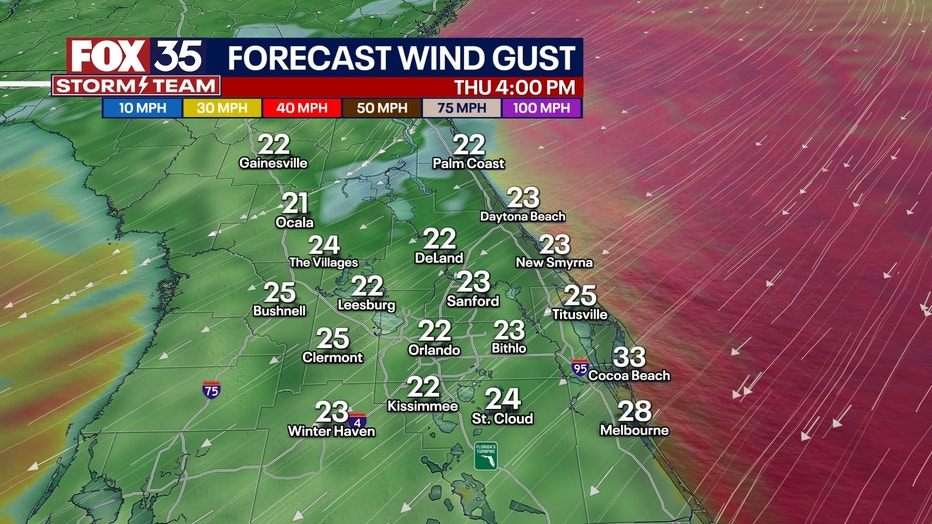
Expect lots of clouds, increasing breezes and even a few isolated showers this Thursday. Rain chances hold steady at 20% as a few showers blow by in the increasingly strong Northeast breeze. Highs will hit in the low-mid 70s this afternoon. Gusty winds, especially along the coastal areas, will contribute to a beach erosion threat during times of higher tides. High tide will start at 10 a.m. and again tonight around 10 p.m. If it's garbage or recycle pick-up day where you live, it's a good idea to secure any loose objects as the winds get quite gusty by this afternoon.
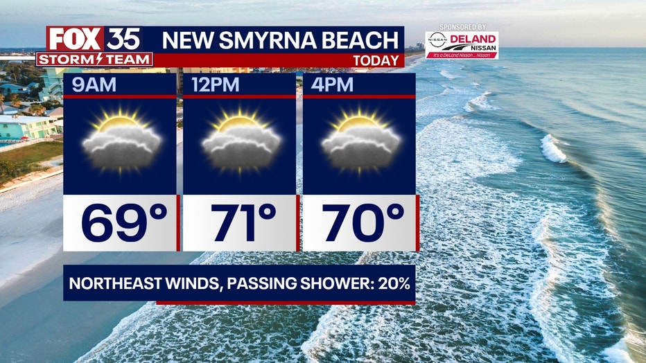
BEACHES:
The beaches see lots of clouds and increasing breezes on this Thursday. Surf will continue building into the 6-9' range as seas and surf respond to the tremendous increase in Northeast breezes. Gusts today could approach or even breach the 35mph mark. Coastal erosion and shallow coastal flooding will be of issue during the the late morning and late evening high tide cycles. Highs seaside will hit near the lower 70s this afternoon.
THEME PARKS:
The theme parks see mostly cloudy skies and windy conditions. A brief passing shower will also be possible this afternoon, coverage looks rather low at 20%.

OUTLOOK:
With the exception of gusty winds, things look relatively quiet as we close out the week. Our next best chance for rain will arrive on Saturday and Sunday as the Gulf of Mexico low pressure cranks up and heads closer to Florida. We've issued FOX 35 STORM ALERT DAYS to address the heavy rain threat and gusty winds-we're also monitoring for severe weather during this time. Damaging winds and even a few isolated tornadoes will be possible.

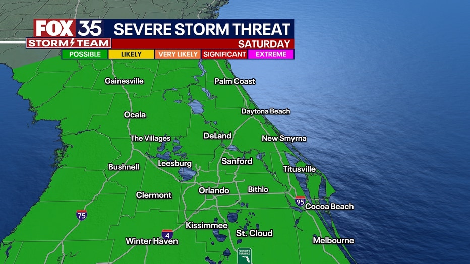
Both the GFS and European forecast models feature heavy rain and gusty winds beginning on Saturday. Saturday afternoon might present a window of severe weather opportunity as the system's warm front moves across Central Florida. Rain amounts will cash in around the 2-5" mark during the duration of this weather event. Severe risk falls off late Saturday, especially if the low speeds up, moving into the Carolinas then.
Sunday morning will offer up a few showers and continued gusty winds. Big improvements in the local weather by late in the day on Sunday and into Monday of next week. Depend on the FOX 35 Storm Team as we will bring you the latest weather updates.