

Tropical Storm Bret & Invest 93-L tracker: Atlantic systems expected to strengthen, NHC says

The National Hurricane Center is monitoring two tropical systems in the eastern Atlantic Ocean: a tropical storm that's forecast to become a hurricane; and the second, a tropical wave several hundred miles away that has some potential of becoming a tropical depression.
Here is what you need to know about both.

Tracking Tropical Storm Bret
A tropical wave strengthened over the Central Atlantic Ocean on Monday to become Tropical Storm Bret – about 1,300 miles east of the Southern Windward Islands – and is expected to continue to strengthen into a hurricane.
The system is moving west at 21 mph, has maximum sustained winds of 40 mph, and a minimum central pressure of 1008 mb, the National Hurricane Center said in its latest advisory. It's expected to continue moving in that direction over the next several days – and is expected to approach the Lesser Antilles islands late this week.
Those who live in the Lesser Antilles islands, Puerto Rico, and Virgin Islands have been urged to "closely monitor updates" and have a hurricane plan in place.
Tracking Disturbance #2: Invest 93-L
Disturbance #2, also known as Invest 93-L, is located several hundred miles east of Tropical Storm Bret that's expected to become Hurricane Bret, the National Hurricane Center said. It's currently several hundred miles south-southwest of the Cabo Verde Islands.
Invest 92L is moving to the west at 16 mph and is expected to continue moving across the central Atlantic over the next several days.
"Further development of this system is possible, and a tropical depression could form within the next few days while the system moves westward at 10 to 15 mph across the eastern and central tropical Atlantic," the NHC said.
According to the NHC, Invest 92L has a 90% chance of developing into a tropical cyclone over the next 48 hours and a 90% chance of developing over the next seven days. If the disturbance organizes and forms a center, it will be known as Tropical Depression Three.
It's too early to know for sure where Invest 92L is headed, but there is consensus in computer models that the system will head west and be in the vicinity of the Lesser Antilles by the end of next week.
What is an Invest system?
An invest system is short for "investigative system" or "area of interest". The invest tag is reserved for areas of disturbed weather being monitored for potential tropical development. Once the National Hurricane Center ear-marks an investigative area, spaghetti forecast models are applied to the situation, helping to forecast future tracking.
Invests are identified by numbers ranging from 90-99, the letter "L" is attached if the system resides in the North Atlantic.
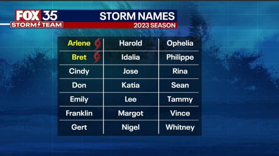
2023 Atlantic Hurricane storm names
Preparing for hurricane season: What you need to know
FOX 35 Tracking The Tropics: 2023 Season Preview
The FOX 35 Storm Team takes a look at how many storms we could see this year, how El Niño could impact this year's season, a new tool that could help protect your home, and a look inside Florida International University's "Wall of Wind."