Invest 97L: Tropical system likely headed towards Gulf of Mexico, U.S. Gulf Coast
ORLANDO, Fl - An area of showers and thunderstorms in the Caribbean is expected to develop into a tropical depression this week as it heads towards the Gulf of Mexico, where models suggest it will then become a tropical storm or a hurricane.
The next storm name on the 2024 Atlantic hurricane list is Helen.
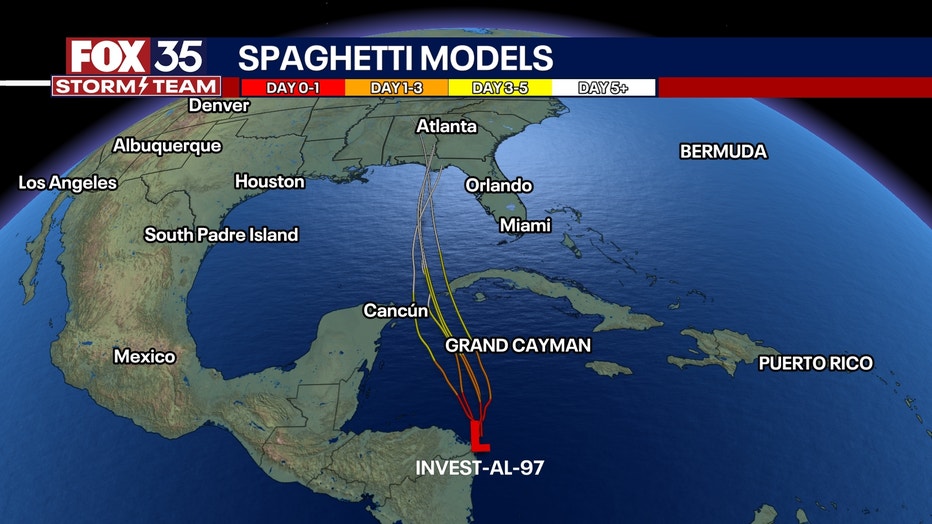
The National Hurricane Center designated this disturbance as Invest 97L, which means forecast models can now be generated to see potentially where this system may travel across the Caribbean and Gulf of Mexico, towards the Gulf coast of the United States.

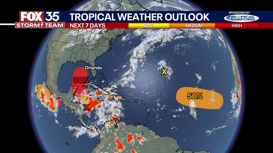
In its latest advisory, the system had a 80% chance of further development over the next seven days, and a 40% chance of development for the next two days.
"Regardless of development, this disturbance is expected to produce heavy rains over portions of Central America during the next several days. Interests in the northwestern Caribbean, Yucatan Peninsula of Mexico, and western Cuba should closely monitor the progress of this feature," NHC said.
"Later this week, the system is forecast to move generally northward across the Gulf of Mexico, and interests along the northern and northeastern Gulf Coast should also monitor the progress of this system."
Will Invest 97L hit Florida?
It's still too early to tell whether this potential system will have a direct or indirect hit on Florida. Models and the NHC suggest that it is expected to make a northeastern turn in the Gulf of Mexico.
The FOX 35 Storm Team said while we're a few days too early to know exactly what type of impact Florida could see, tropical rainfall will likely impact Florida mid-week and throughout the weekend.
Invest 96L: Central Subtropical Atlantic
A disturbance designated as 96L now has a 0% chance of further development as the showers and thunderstorms associated with it have diminished, the NHC said.
"Development of this system is not expected due to dry air and increasing upper-level winds during the next couple of days while the low moves generally northward at 5 to 10 mph," the NHC said.

Eastern and Central Tropical Atlantic:
A tropical wave in the eastern tropical Atlantic has a 50% chance of further development, according to the NHC.
The NHC said environmental factors seem to support gradual development with the possibility that a tropical depression could form next week as it continues to move across the Atlantic.
It has a 50% chance of development over the next seven days.

