Orlando weather forecast: Showers, strong storms to impact Central Florida this weekend

Orlando Weather Forecast: Stormy Sunday ahead
Saturday will be mostly dry and pleasant before rain settles over Florida on Sunday. Storms are possible on Sunday afternoon over parts of Central Florida.
ORLANDO, Fla. - Another El Niño-fueled storm is set to impact Florida on Sunday. It will bring impacts, including showers, storms, gusty winds, and high surf. The gusty wind and surf action will linger through much of next week, believe it or not.
A complicated atmospheric pattern will yield a large low-pressure system that originated over California and in the eastern Pacific Ocean to get squeezed and shoved southeastward towards Florida as an atmospheric "roadblock" sets up over New England.
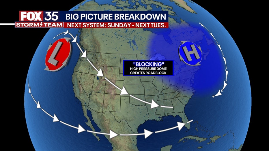
The storm will slow to a snail's pace and even orbit a few times over Florida early next week into Tuesday.
Timeline: When is the rain expected to arrive in Florida?
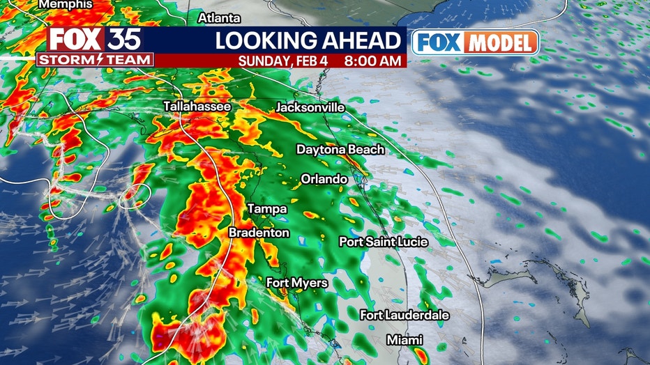
Showers and storms arrive at Florida's west coast around daybreak Sunday and will push eastward during the morning. Arrival in central Florida is probably around mid-morning.
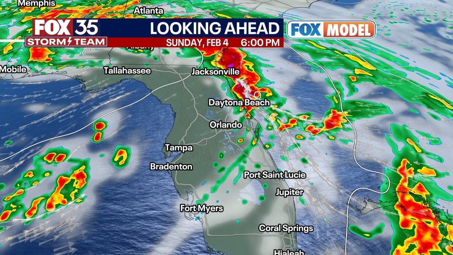
There will be showers, downpours, and thunderstorms embedded within this activity -- which will peak late morning and midday. Torrential bursts of rain are possible at times.
By mid-afternoon, a lot of the activity should start pushing off the east coast and into the Atlantic Ocean. A few hours of dry time may arrive by late afternoon and evening for central and north-central Florida. More showers and non-severe thunder will form around the base of the low-pressure system late Sunday night and into Monday, lasting off and on through Monday night.
How much rain could fall in Central Florida this weekend?
Up to 2" of rain is expected area-wide, with isolated areas over 2" of rain possible. Any thunderstorm may produce lightning and gusty winds. Winds outside of any thunderstorm will be quite gusty and could be 25-35 MPH.
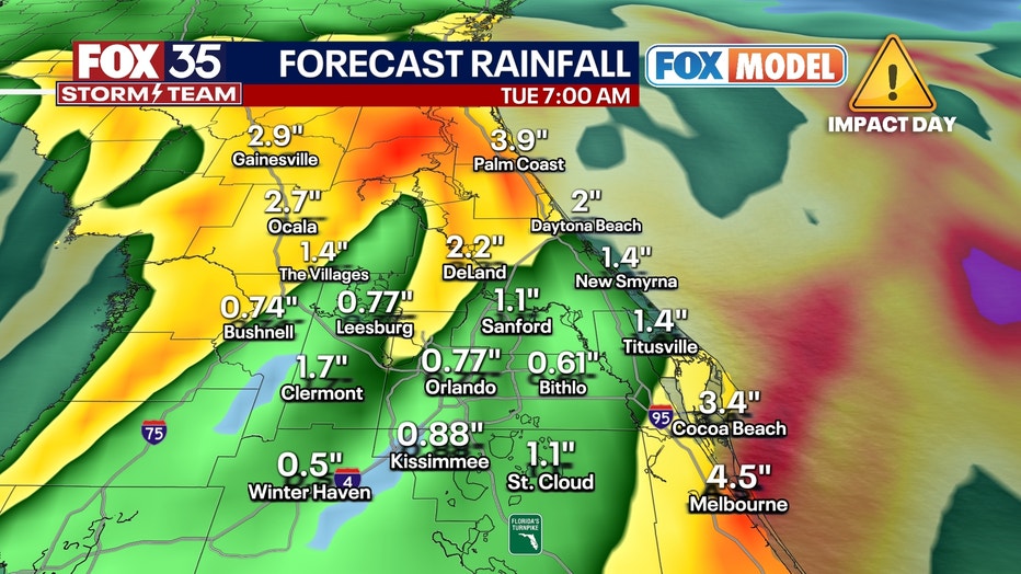
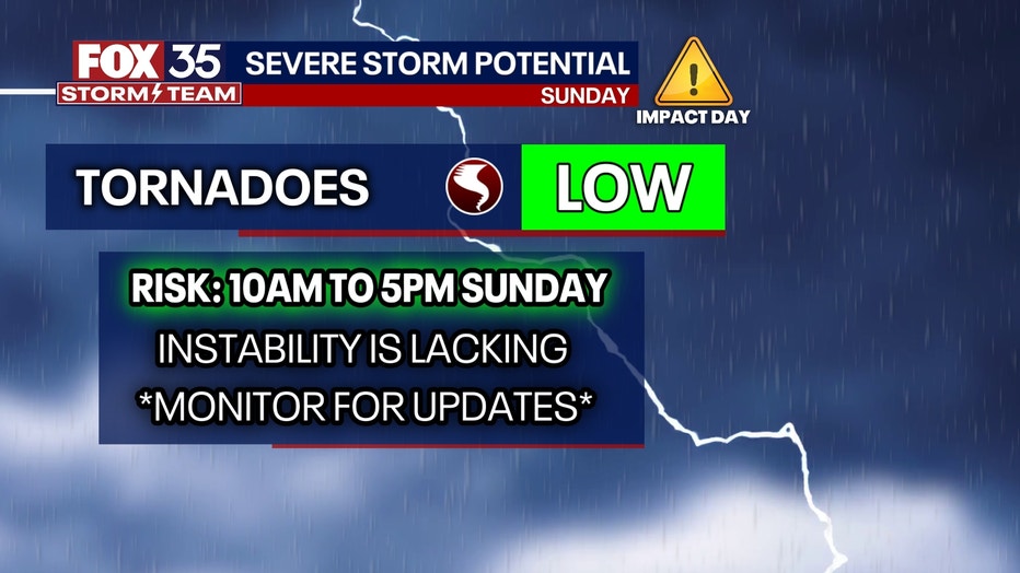
Regarding severe storm risk, it appears to be low as of now. Wind energy aloft in the atmosphere is extremely impressive, but the storm fuel (CAPE) is very low -- which could inhibit the risk for any of those storms to turn severe. That said, a small chance for a brief tornado or damaging wind gust or two exists in the afternoon, esp. areas north of Orlando. If the amount of instability (temperature and dew point) rises any more on Sunday leading up to the event, then the risk may increase.
Monday and Tuesday, the low sits and swirls over Florida and produces sporadic showers and bursts of rain, gusty winds, and high surf. Dangerous swimming weather will linger through all of next week for Florida's east coast beaches. Not until Wednesday next week do we get back to mostly sunny weather and dry conditions.
Stay tuned for more as we get closer.

