

Orlando weather: Toasty temps continue to dominate this weekend; Rain chances increase next week

ORLANDO, Fla. - Today's high: 93 degrees | Tonight's low: 76 degrees
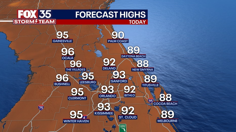
Main weather concerns: Toasty temps and dry, sunny skies for Central Florida on this Friday. Highs hit in the lower to mid 90s inland, closer to the upper 80s along the beaches as ocean breezes continue. Rain chances are at 10% or less.
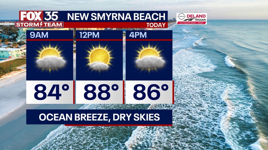
BEACHES: At the beaches today, you can expect a nice breeze out of the northeast. Gusts could reach 15-20 mph. Temperatures will reach the upper-80s today with feels-like temperatures near 100 degrees. Stay hydrated and don't forget your sunscreen. Friendly reminder, there is a moderate risk for rip currents.
THEME PARKS: We have a hot and humid day at the theme parks on this Thursday. Highs nearing 92 this afternoon with a mix of sun and clouds. A scattered shower or storm is possible this afternoon, but coverage remains low at 20%. Stay hydrated and take breaks inside the a/c.

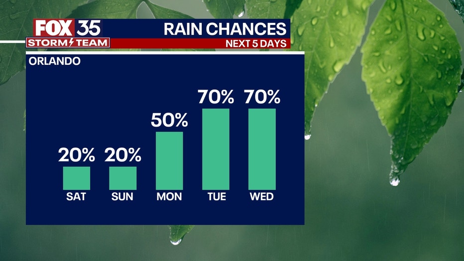
OUTLOOK: Rain chances stay low through the end of the week and into the start of the weekend. Heat will be increasing, running up into the mid-upper 90s by the coming weekend.
Rain chances will increase slowly by early next week. We could see an increase in tropical moisture in the Gulf of Mexico by next week bringing the chance for heavy rain and increase in breezes. We will continue to update you on the latest.
TRACKING THE TROPICS: The tropics remain active! Tropical storm Franklin is moving into the Atlantic today. Conditions remain ripe for further intensification over the next several days. Franklin will likely become a hurricane during that time.
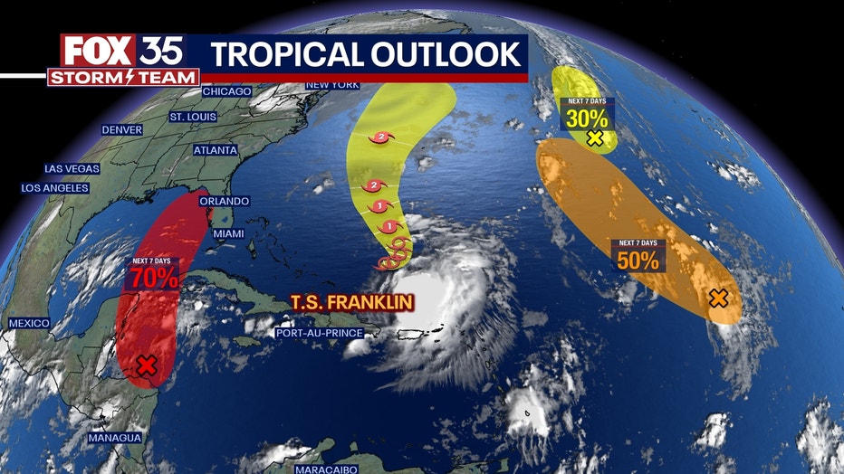
Well to the east of Franklin, the remains of Tropical Storm Emily has a 70% chance of developing over the next 7 days. A secondary tropical wave over the distant Eastern Tropical Atlantic has a 40% of developing over the next 7 days.
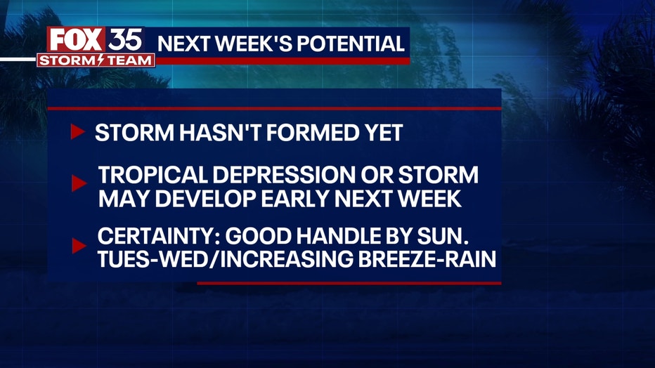
There is also an area in the northwestern Caribbean Sea where an area of low pressure could form over the next few days.
Some gradual development of this system is possible over the weekend and early next week, and a tropical depression or storm could form while it moves slowly northward across the eastern Gulf of Mexico.
The FOX 35 Storm Team will be tracking the tropics, so be sure to depend on us always! Click here to download the FOX 35 Storm Team Weather App.