

Orlando weather: More showers, storms on the way for Central Florida
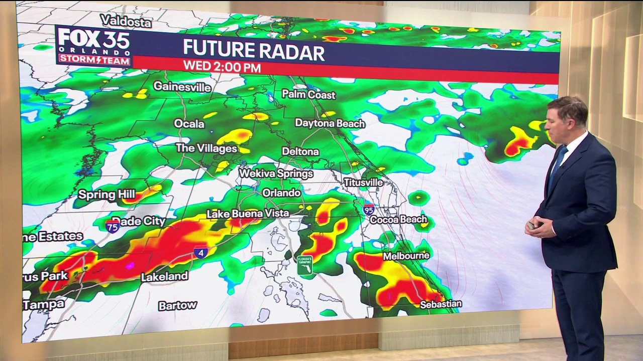
Orlando AM Weather Forecast: Another rainy day for Central Florida
Central Florida is set for another rainy day, with showers expected throughout the day. FOX 35 Storm Team meteorologist Brooks Garner takes a look at the forecast.
ORLANDO, Fla. - Wednesday will be another wet day across Central Florida.
Multiple rounds of showers and embedded thunderstorms are expected, with rain chances around 80–90%.
How much rain will we get?:
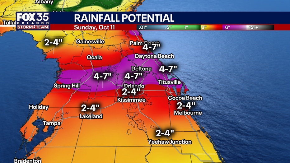
Many areas could pick up around 2 inches of rain today, with isolated totals closer to 4 inches, especially where heavier downpours repeatedly move over the same locations.
Because the ground is already wet from recent rain, minor flooding will be possible in poor-drainage and flood-prone areas.
Severe weather is not expected to be widespread today. Most of the day will simply be cloudy, damp and rainy, although a stronger storm south of Orlando could produce a gust near 45 mph.
Temperatures will stay unusually cool north of Melbourne, with many areas only reaching the upper 70s to low 80s. Farther south, where a few breaks in the clouds are possible, highs could reach the upper 80s.
Where it warms up into the mid/upper 80s, the heaviest storms are likely this afternoon, dumping up to 3 to 4 inches per hour!
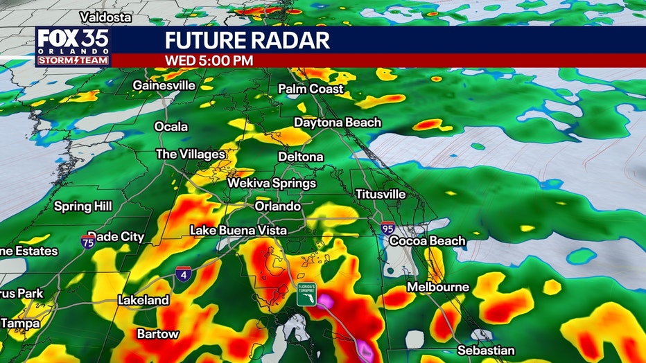
Wet pattern continues
Thursday looks like more of the same.
Deep tropical moisture and a stalled front will keep rain chances around 80%, with another widespread 2 inches of rain possible and isolated pockets approaching 4 inches.
Friday remains wet too, although rainfall totals should begin to decrease somewhat as the front slowly lifts north.
Tracking Tropical Storm Isaias
Tropical Storm Isaias was born at 5 a.m. and is forecast to strengthen into a hurricane Thursday.
The system should turn northeast and then north, approaching the northern Gulf Coast Friday before making landfall late Friday night or early Saturday morning between NOLA and Pensacola.
It is forecast to grow to a Category 2, before weakening as it approaches land, into a Category 1. It'll encounter wind shear and drier air to start to tear it apart.
Storm surge and tornadoes will be possible along and just east of its track Friday night and Saturday, including our Florida Panhandle.
Central Florida impacts?:
No direct impacts on Central Florida, beyond a higher rain chance.
When will we finally dry out?
The better news comes next week.
As the Gulf system moves away and high pressure strengthens, winds should eventually turn more northerly and begin pushing some of this deep tropical moisture out of Florida, but that may not happen until Monday.
Rain chances should gradually decrease early next week, with much drier weather potentially arriving by the middle of next week.
Until then, keep the umbrella close. This is going to be a soggy stretch.
The Source: The information in this story was provided by the FOX 35 Storm Team.