Orlando Weather Forecast: Storms likely in Central Florida early Sunday afternoon
Weather Forecast: September 25, 2022
The FOX 35 Storm Team has a look at Sunday's forecast, as well the upcoming week.
Today's high: 89 degrees | Tonight's low: 72 degrees | Rain: 30%
Main weather concerns: Isolated to scattered showers in the Atlantic will start to push along the Treasure coast. Early afternoon, these same showers will push into the interior. Most of the activity will be from Seminole County and South towards Osceola, tracking eastward. Main concerns associated with some stronger storms are lightning strikes, gusty winds, and heavy rain.
BEACHES:
Surf along the beaches will still be higher than usual on Sunday, with surf around 3 ft. The rip current risk will be moderate. When getting into the water, make sure to swim next to a lifeguard stand. There will be a 30% chance of rain with higher chances in the afternoon. High temperatures peak at 85 degrees tomorrow.

THEME PARKS:
Saturday is a perfect day for the parks. Rain chances are slim at 30 percent. The highest chances of rain will come after 2 pm. Some stronger storms can produce heavy rain and lightning. Make sure to stay weather aware. High temperatures will peak in the upper 80s. Make sure to stay hydrated and take breaks.
EXTENDED OUTLOOK:
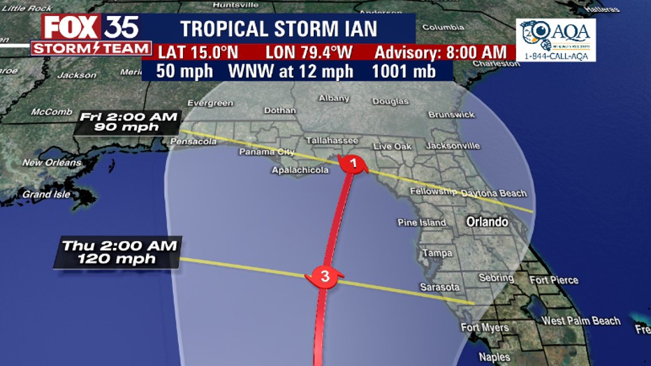
The FOX 35 Storm Team is tracking Tropical Storm Ian in the Southern Caribbean. Our chances of rain will increase throughout the week as the storm moves closer. Impacts can be felt as early as Tuesday.

TROPICS:
Tropical Storm Ian is moving across the Western Caribbean Sea. Ian is expected to rapidly intensify to a Cat. 1 hurricane later Sunday, or early Monday morning. Ian is projected to become a major hurricane by midweek and track across Southwestern portions of Cuba.

Ian will then move into the Eastern portions of the Gulf of Mexico, where it will gain strength in the warm water. There Ian is forecast to become a major hurricane before weakening to a Cat 1 and moving into the panhandle of Florida.

Now is a good time to prepare for what is to come. Depend on the FOX 35 Storm Team for the latest this weekend and beyond!

