Orlando weather forecast: Storm chances linger into Wednesday evening for Central Florida
Weather Forecast: Sept. 7, 2022
Orlando and Central Florida can expect evening showers over the metro area, but they will move to the western part of our viewing area as the night progresses.
ORLANDO, Fla. - Thursday will see a sharp rise in afternoon showers and storm coverage. Chances move up mainly after 2-3 pm. Don't rule out a shower or isolated storm before that.
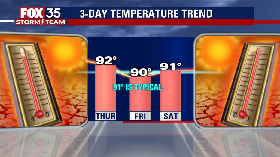
Tonight's low: 74 degrees | Tomorrow's high: 92 degrees | Rain: 80% chance PM Storms
Main Weather Concerns: Weather threats appear to be very heavy rain and lightning. High temps continue in the low-mid 90s, closer to 90 along the beaches. Rain eases by mid-late evening, down to 40% or less by 10 pm.
BEACHES:
Shower and storm chances will increase on Thursday. A few showers will be possible as the sea breeze develops by late AM. Bigger rain chances take shape after 2-3 pm as storms drift back towards the coast. Beach visitors and residents alike should be on the lookout for lightning strikes and areas of heavy rain.
Rip current risk is also on the rise, at moderate levels. Ocean swell from distant Hurricane Earl will increase a bit today, filling in and growing in size by late week into the weekend. Surf is in the 2-3 feet range today as a mix of swell slides into the local coastal waters.
THEME PARKS:
Hot and humid conditions will continue today with feels like temperatures in the triple digits. Stay hydrated and take breaks inside the a/c. The best chance for rain is between 3 pm-7pm. Heavy rain and lightning will be likely.

EXTENDED OUTLOOK:
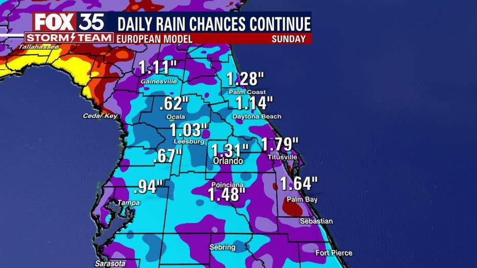
Rain chances move up to 60%-80% today. Heavy rain and lightning will become the marquee threats each afternoon through Sunday. Tropical moisture is increasing and this feature will bring rain to all Central Florida locations through the weekend. Most of the rain will develop on the PM side of the day but, with such heavy tropical moisture at play, don't rule out rain drops before the PM hours!

TROPICS:
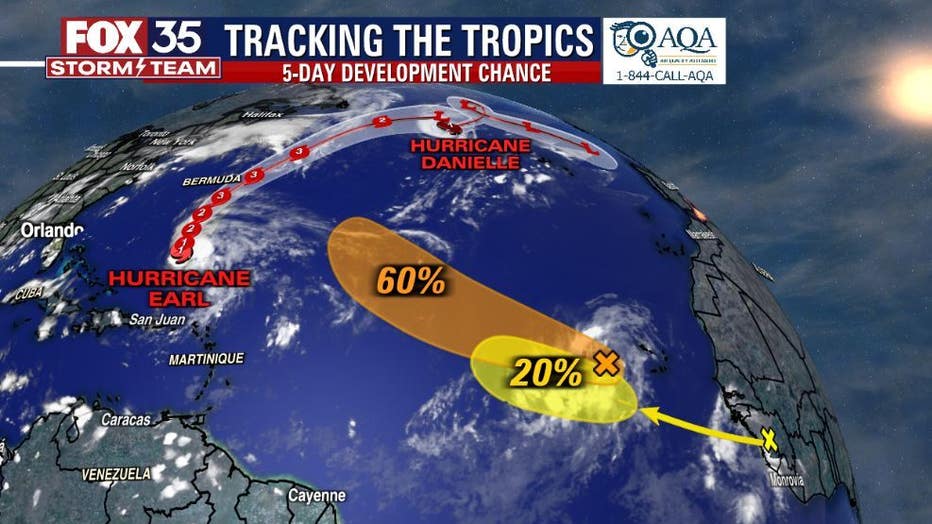
Hurricane Danielle is on a slow decline as it moves northeastward over the open north Atlantic. Hurricane Earl is well East/Northeast of the Islands and stays away from land longer term but grows in size.

A tropical wave located southeast of the Cabo Verde Islands has a 60% chance of becoming a tropical depression later this week. Secondary wave moves off Africa soon, 20% chance of development. None of these systems pose a threat to Florida.
Remember to stay alert as we approach the peak of the hurricane season, which is on September 10th. Track the tropics in real-time on the FOX 35 Storm Team weather app.

