

Orlando Weather: Overcast skies as rain chances finally lessen
Some much-anticipated changes are finally making their way into Central Florida, bringing much drier weather for the second half of the weekend.
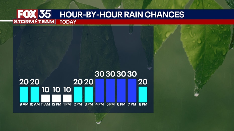
Despite the clouds and the overcast skies, much of Sunday is expected to be rain-free. There is a 20%-30% chance of isolated showers and thunderstorms later this afternoon. Those chances fade by the evening hours.
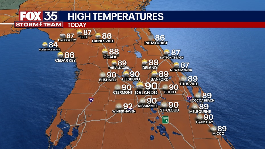
Afternoon highs will be seasonable with most spots seeing highs near 90 degrees.
LOOKING AHEAD:
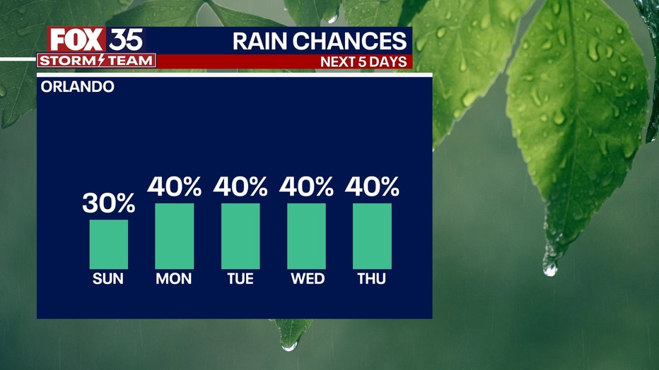
If you're hoping for a break from the soggy and stormy weather, you're in luck! While rain and storms are still in the forecast for this week, chances will be much lower.
Dry air will be filtering in at the start of the week and will give way to more isolated/sea breeze driven showers and storms.
A 30%-40% chance can be anticipated for much of next week and slightly lower humidity levels as well.
Tracking The Tropics
Tropical Storm Gordon will continue to meander across the central Atlantic. It's forecast to weaken into a tropical depression in the next day or so before becoming a remnant low later this week.
Invest 95-L has also formed off the coast of Georgia and the Carolinas. As of right now, it's a non-tropical area of low pressure.
As it slowly moves over the warm Gulf Stream, some development of tropical characteristics will be possible. This means a tropical or subtropical storm could form over the next couple of days.
If it's able to become a tropical storm, its name would be Helene.
Regardless of it's tropical development, it will likely bring gusty winds, heavy rains with the potential for flash flooding, coastal flooding, and dangerous beach conditions to parts of the Southeast and Mid-Atlantic coast in the next couple of days.