Orlando weather: Rain chances drop for Thursday across many parts of Central Florida

Orlando Weather Forecast: Aug. 7, 2024
Central Florida continues to experience residual impacts from Tropical Storm Debby. Breezy west winds of 5-15 mph, with occasional gusts over 20 mph, are expected. Overnight temperatures will remain unusually mild, hovering near 80 degrees above average.
ORLANDO, Fla. - Central Florida continues to experience residual impacts from Tropical Storm Debby. Breezy west winds of 5 to 15 mph, with occasional gusts over 20 mph, are expected.
Overnight temperatures will remain unusually mild, hovering near 80 degrees above average.

Looking ahead, rain chances for Thursday and Friday are below the mid-summer average. Only a few isolated showers are anticipated. However, typical rain patterns for Central Florida will resume on Saturday, with a 60% chance of rain extending into next week.
The weekend will be hot and humid, with temperatures in the mid-90s and heat indices reaching 105 to 110 degrees.
Tracking the Tropics
Tropical Storm Debby is projected to move up the East Coast this weekend, bringing heavy rainfall to West Virginia, central Pennsylvania, Upstate New York, and Vermont. Tornadoes are also possible in parts of New York and Pennsylvania.


Meanwhile, North Florida and the Big Bend regions continue to recover from Debby, with power being restored to the counties hit hardest. Jackson County has the highest percentage of outages at over 30%.

Central Florida can expect a brief lull in tropical activity over the next five days. A small tropical wave in the Caribbean is now tracking too far south to develop, with its development odds reduced to less than 10%.
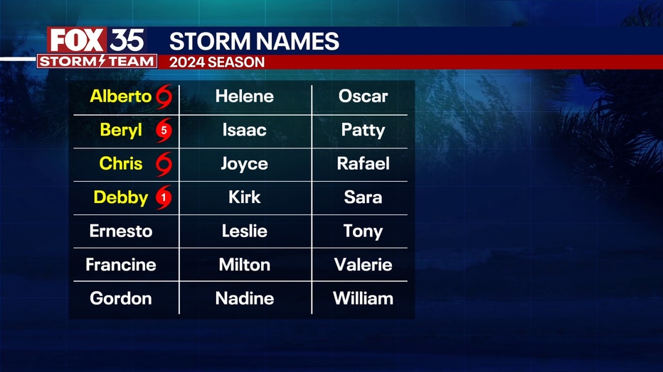
However, a tropical wave expected to arrive mid-to-late next week could encounter a very favorable environment, likely leading to development as it heads towards the Bahamas and the Caribbean. The next storm name on the list is "Ernesto." While it is too early to predict its exact path or potential impact on the United States, conditions appear conducive for tropical strengthening.
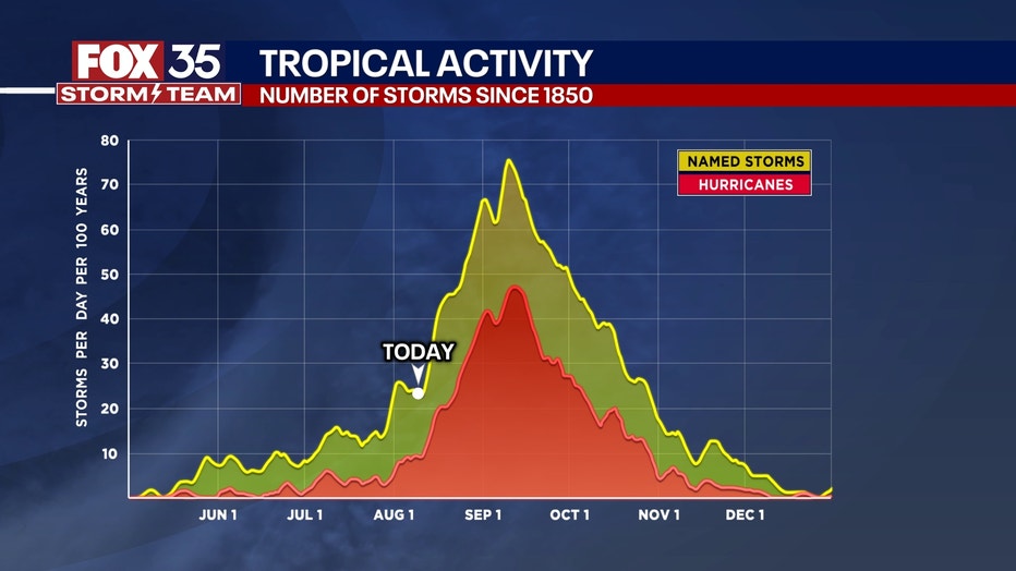
We've now surpassed the climatological start of the BIG ascent to the peak of the hurricane season. Tuesday marked that day when we typically see the most activity in both storm number and intensity as we head to the peak on Sept. 10.
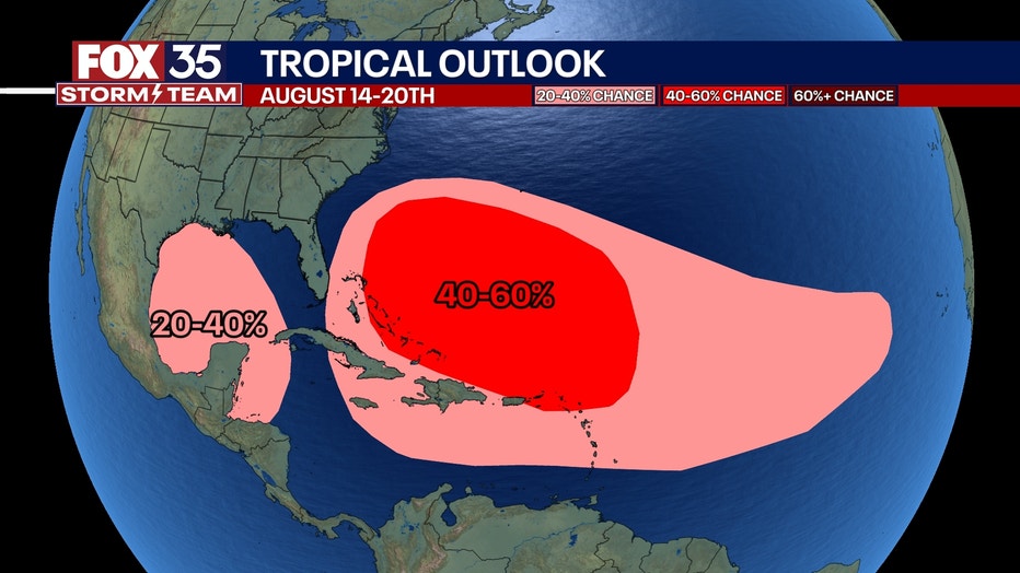
In the next two weeks, we have a very likely chance of a tropical system developing. So far, there are no apparent threats to Florida.
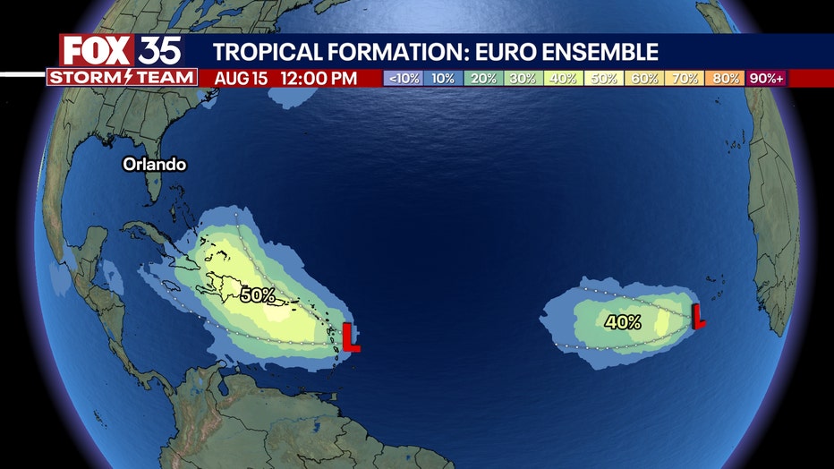
"Mid to late next week we should have two distinct waves to watch," said FOX 35 Storm Team Meteorologist Noah Bergren. One model shows the odds of development at 40% and 50%.
"I really think the first one has a really good chance to become a named storm," Bergren added. "Guidance is split on an eventual out-to-sea track or something more threatening."
There will be a third wave behind this by August 20.
Orlando 7-Day Weather Forecast

Orlando Hour-by-Hour Weather Forecast

FOX 35 Storm Tracker Radar
Track live when storms move across your area using the FOX 35 Storm Storm Tracker Radar below.

More radar maps from FOX 35 Storm Tracker Radar
- Brevard County
- Flagler County
- Lake County
- Marion County
- Osceola County
- Orange County
- Polk County
- Seminole County
- Sumter County
- Volusia County
- U.S./National Radar
Stay connected with FOX 35
- Download the FOX 35 News app for latest news, weather, and traffic alerts
- Download the FOX 35 Storm Team Weather app for live, interactive radar
- Visit FOX35Orlando.com/weather for interactive radar, plus updated weather graphics, maps, and images

