

Orlando weather: Cold front bringing coldest air of the season to Central Florida
Orlando Weather Forecast: Colder air coming
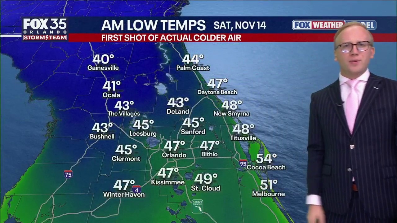
The first 40s of the fall are on the way for this weekend to central Florida. FOX 35 Storm Team Senior Meteorologist Noah Bergren is tracking the big drop in temps. and when more rain arrives to Orlando.
ORLANDO, Fla. - A highly anticipated powerful cold front is slated to move through this evening and into the overnight. This will be a dry front, so no additional rainfall is expected.
But behind the front there will be dramatically cooler and drier air, ushering in some of the coldest temperatures since March this weekend.
Big changes into the weekend
What's next:
Cooler temperatures and sunshine arrive just in time for this weekend.
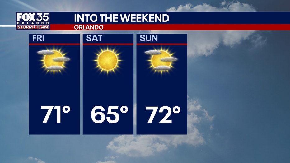
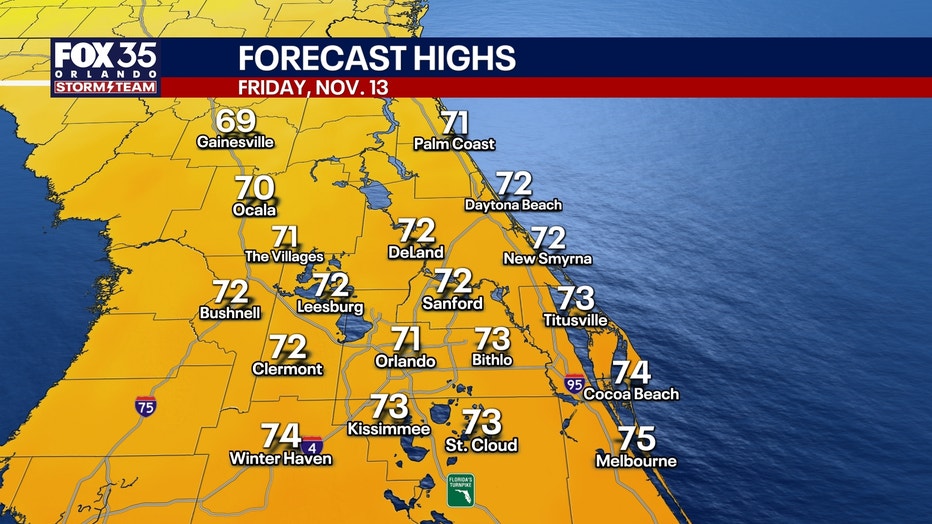
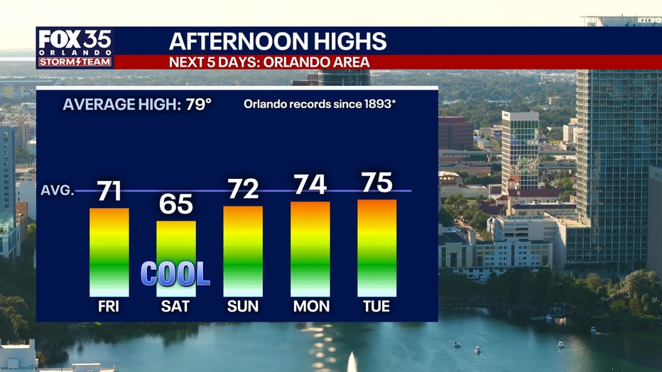
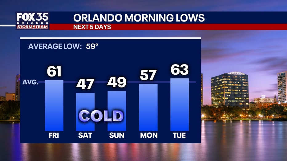
Temperatures will fall overnight into the 50s on Friday morning, and afternoon highs will only make it into the upper 60s and low 70s. It will be breezy as winds gust up to about 20–25 mph.
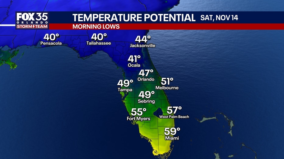
Morning lows will be chilly for this weekend, dipping down into the 40s both Saturday and Sunday morning. Once we factor in the breezy winds, wind chills could dip into the upper 30s north of Orlando and the low to mid 40s for communities near and south of Orlando.
Even with the help of mostly sunny skies, afternoon highs will also be well below normal. Plan for a high of 65° in Orlando Saturday and 72° Sunday.
Our two coldest mornings will also be on Saturday and Sunday, with lows reaching around 47° and 49°, respectively.
Warmer and unsettled next week
Temperatures bounce back into the mid 70s next week as a more active and unsettled pattern takes shape.
This will mean the potential for rounds of rain and a few thunderstorms. However, there is still quite a bit of uncertainty in the data. Stay tuned.
The Source: The information used in this story was provided by the FOX 35 Storm Team meteorologists.