NHC says tropical wave in western Caribbean now has 'limited' chance of development

Orlando Weather Forecast: Aug. 7, 2024
Central Florida continues to experience residual impacts from Tropical Storm Debby. Breezy west winds of 5-15 mph, with occasional gusts over 20 mph, are expected. Overnight temperatures will remain unusually mild, hovering near 80 degrees above average.
ORLANDO, Fla. - The National Hurricane Center (NHC) said a tropical wave in the western Caribbean Sea will continue to produce scattered thunderstorms and locally strong tradewinds, but any potential for tropical development with this wave is limited.
Forecasters said the northern part of the system could reach the southwestern Gulf of Mexico this weekend.
"If it does, there is a low chance of slow tropical cyclone development through the next seven days," the NHC said.
We've now reached the start of the major increase leading up to the peak of hurricane season. Tuesday marked this point, when we typically see the most activity in both the number and intensity of storms, peaking on September 10.
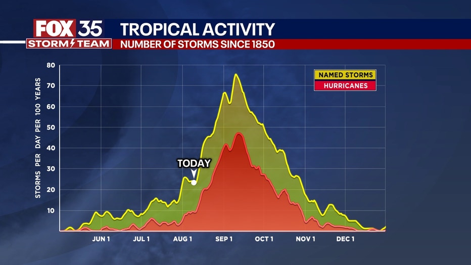
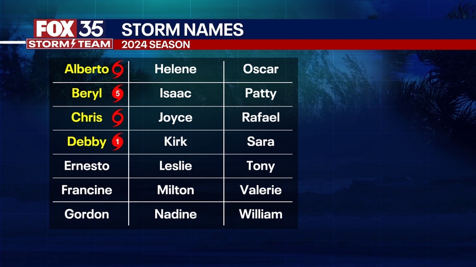
The Atlantic Hurricane Season runs through Nov. 30. Ernesto is the next name on the 2024 Hurricane Season list.
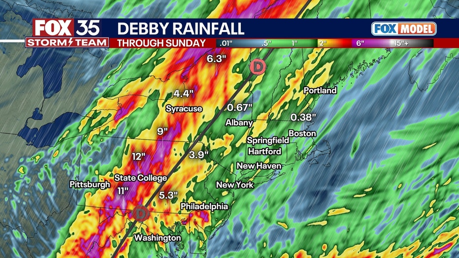
Debby continues up the East Coast this weekend, bringing heavy rainfall to West Virginia, central Pennsylvania, Upstate New York, and Vermont. Tornadoes are also possible in parts of New York and Pennsylvania.

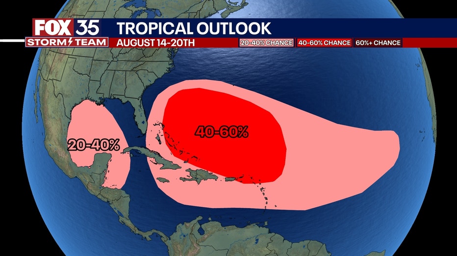
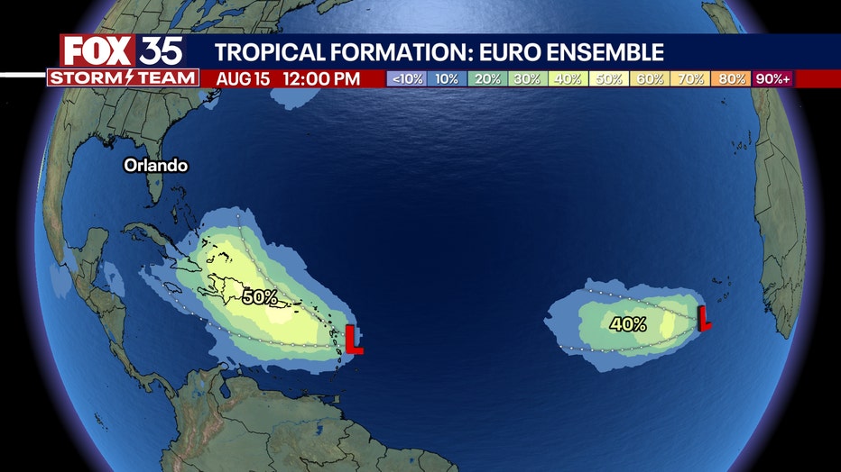
In the next two weeks, we have a very likely chance of a tropical system developing. So far, there are no apparent threats to Florida.
"Mid to late next week, we should have two distinct waves to watch," said FOX 35 Storm Team Meteorologist Noah Bergren. One model shows the odds of development at 40% and 50%.
"I really think the first one has a really good chance to become a named storm," Bergren added. "Guidance is split on an eventual out-to-sea track or something more threatening."
There will be a third wave behind this by August 20.