

Chances increase for development of tropical disturbance in Gulf of Mexico
Stream FOX 35 News
ORLANDO, Fla. - The National Hurricane Center is tracking potential tropical development in the Gulf of Mexico, and conditions are starting to look more favorable.
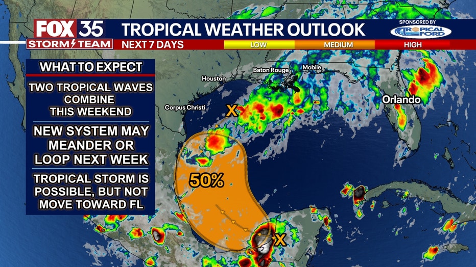
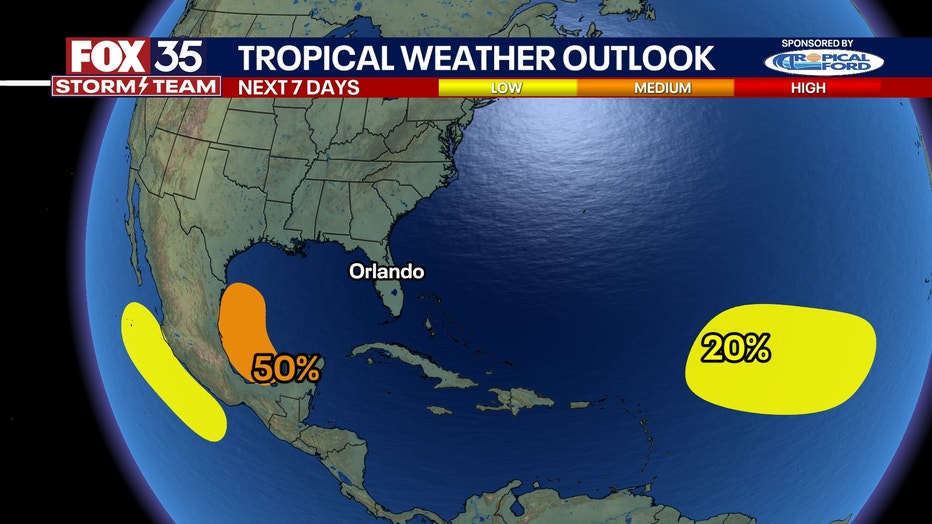
A moderate chance (50%) exists for a system to form early to mid-next week, as two tropical waves are expected to combine, possibly completing one or two loops.
Initially, the system was predicted to move southward in an unusual pattern before stalling and turning north as it developed.
A tropical storm appears plausible, with various models suggesting different tracks: some take the storm into northeastern Mexico, others toward Houston, and some point to Louisiana.
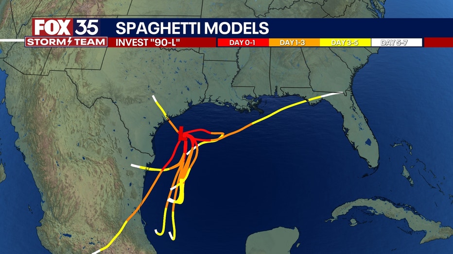
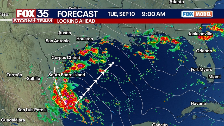
The FOX Model extends only to Tuesday morning and shows a developing tropical storm in the southwestern Gulf, potentially named "Francine." From there, the storm's track could follow a range of paths between the projected white arrows.

Residents along the Texas and Louisiana coasts should closely monitor the situation over the weekend. The longer the system stays over the Gulf, the stronger it could become. If it moves into Mexico earlier, it may remain a disorganized tropical depression and primarily produce heavy rain. However, there’s a scenario where the storm could stay over water longer, tracking into southwestern Louisiana and possibly reaching hurricane status.

Should the storm impact Texas or Louisiana, it would likely occur between late Tuesday and Thursday next week, with no expected trajectory toward Florida.
A second wave in the Central Atlantic Ocean is being monitored for development. It has a low (20%) chance of becoming an organized system over the next seven days.
Orlando 7-Day Weather Forecast

Orlando Hour-by-Hour Weather Forecast

FOX 35 Storm Tracker Radar
Track live when storms move across your area using the FOX 35 Storm Storm Tracker Radar below.

More radar maps from FOX 35 Storm Tracker Radar
- Brevard County
- Flagler County
- Lake County
- Marion County
- Osceola County
- Orange County
- Polk County
- Seminole County
- Sumter County
- Volusia County
- U.S./National Radar
STAY CONNECTED WITH FOX 35 ORLANDO:
- Download the FOX 35 News app for breaking news alerts, the latest news headlines
- Download the FOX 35 Storm Team Weather app for weather alerts & radar
- Sign up for FOX 35's daily newsletter for the latest morning headlines
- FOX Local: Stream FOX 35 newscasts, FOX 35 News+, Central Florida Eats on your smart TV